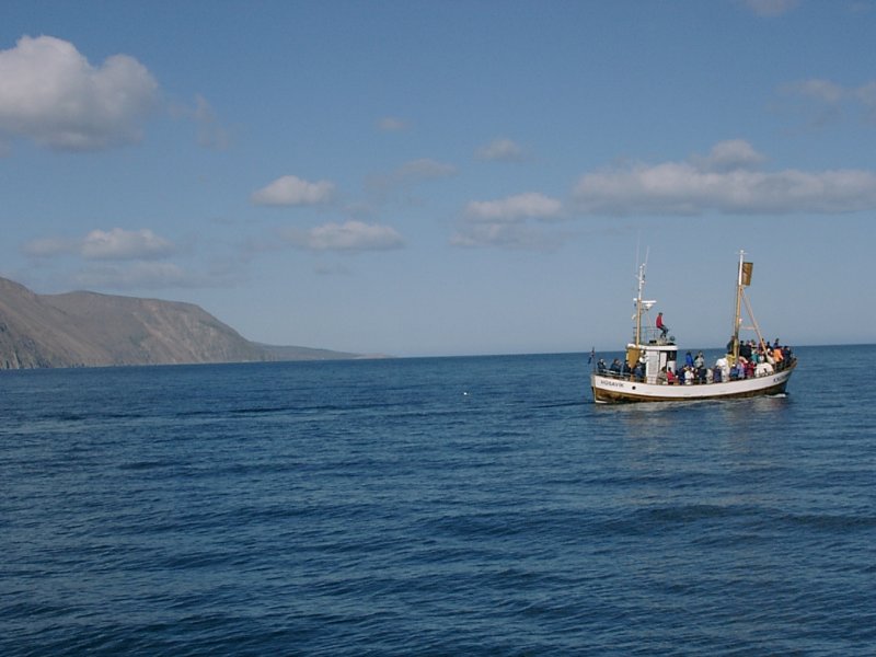
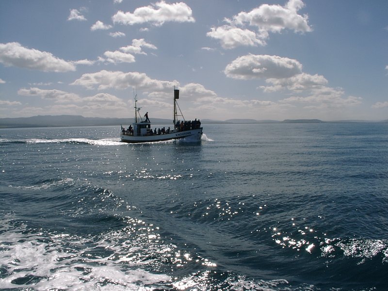
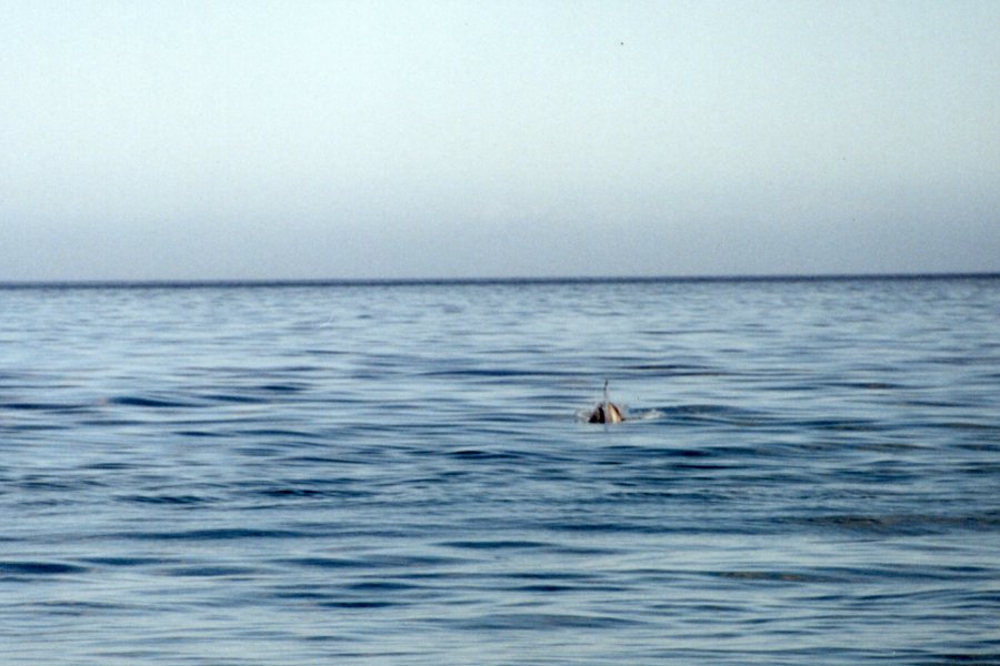
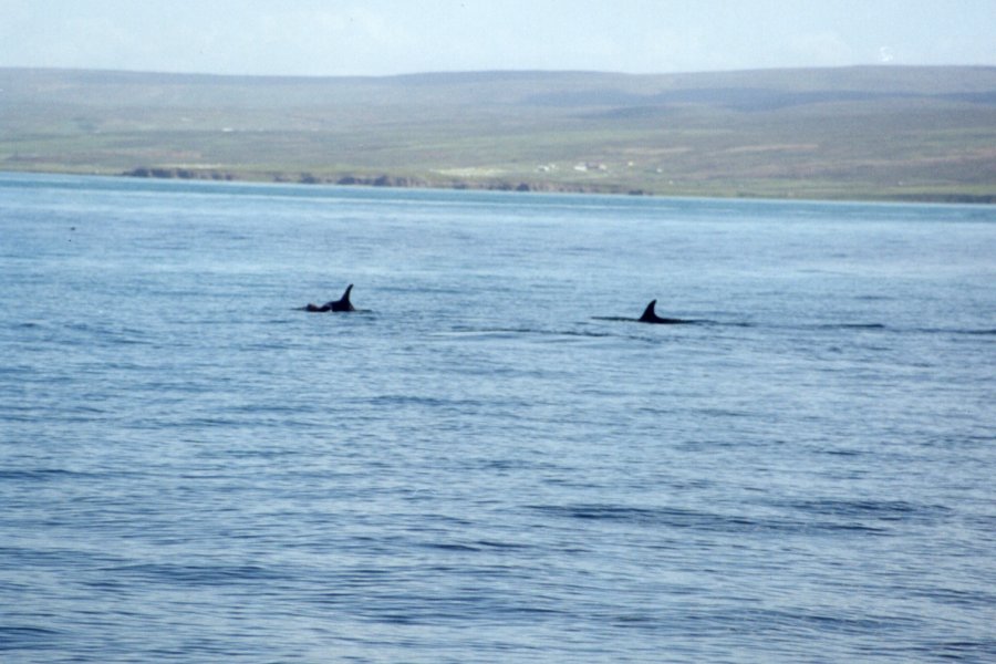
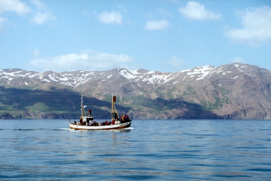
Next day I drove over to Husavik, which is mostly known for whale watching tours. So I get onto one of the ships (there are three of them) and out we go. It's a nice day, calm sea, sunny weather, colorful coast. We manage to spot a mink whale and a couple of dolphins. Fun day.
The whale watching was surprisingly interesting again. While the pictures came out as dull as always (just a couple of black dots on the water), it's just that everyone gets caught up in the chase and it's exciting to see the whale vanish under the surface and then trying to predict where it will come out and hopefully see it. (If you wait until someone else spots it and you follow the pointed fingers, you usually see just the last bit of it when it goes down. Which is mostly the reason for the uninteresting pictures. Usually you see more of the whale when you're actually there. But unless you have pointed the camera at exactly the right spot, the whale will be half gone before you press the camera trigger.)
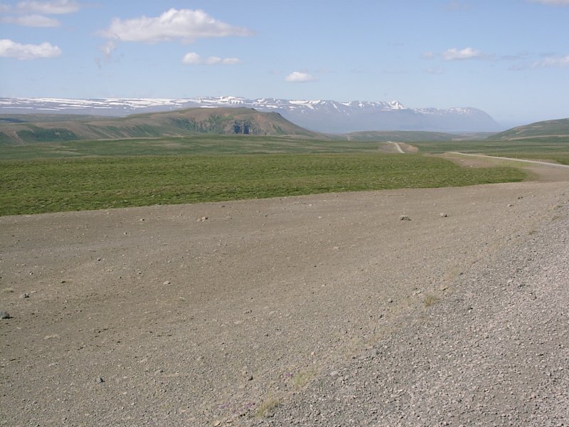
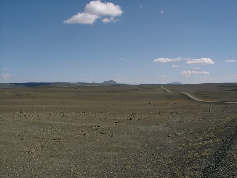
Then I drove down again to the Myvatn lake area.The road to there was once again a gravel road, but this time I really liked it. Why? Hard to tell, but this was the gravel road I should have taken (and none other). Mostly because it was short (just a ninety minute hour drive) and it had all the stuff I had been hoping that the interior road would have offered. It started as a road through green, grassy land with small lakes and the usual sheep standing around idyllically. And about halfway through the green parts suddenly stopped and the rest of the road was gravel through dark sand and lava. Which was almost exactly like the interior road, but it was more compact. So instead of driving all day along a road like this, here was everything on a scale where it was still fun to drive through and watch.
Btw, the next two images were taken from the same spot. The landscape really changes that abruptly. On one side it's all green and you turn around and the other side is a brownish-grey desert. Standing there, all alone, no other car in sight for as many miles as you could see, somewhere on a high plateau, with snow capped mountains somewhere in the distance somehow felt out of this world. For some reason it felt like being somewhere in the Andes.
(Which is probably nonsense, since I've never been there, but the scenery was not something I did expect in Iceland. It reminded me strongly of travelogues I've seen as a child about people driving down transamericana from Alaska to Chile. It's hard to explain while it felt so special standing there on the road and looking at the scenery, but somehow it was a "magic moment" for me. Everyone else is probably just bored by it.)
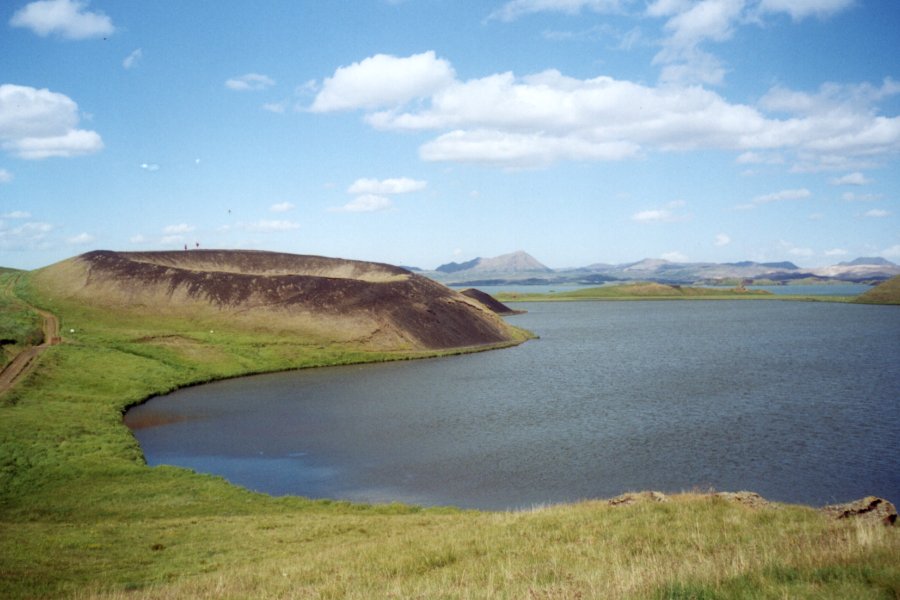
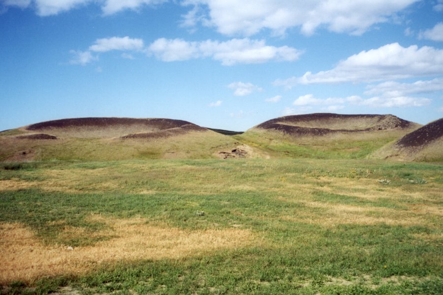
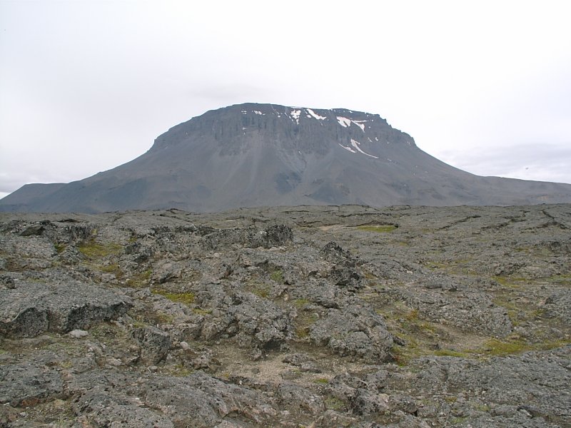
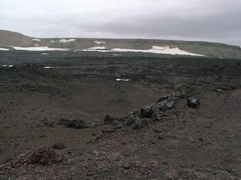
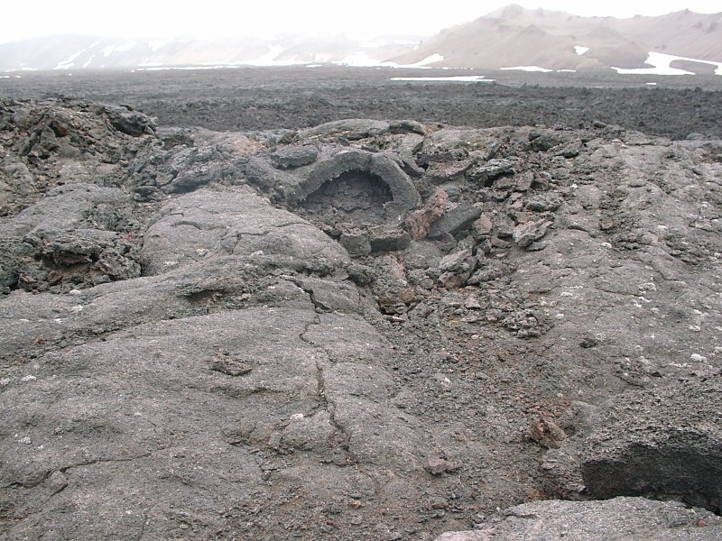
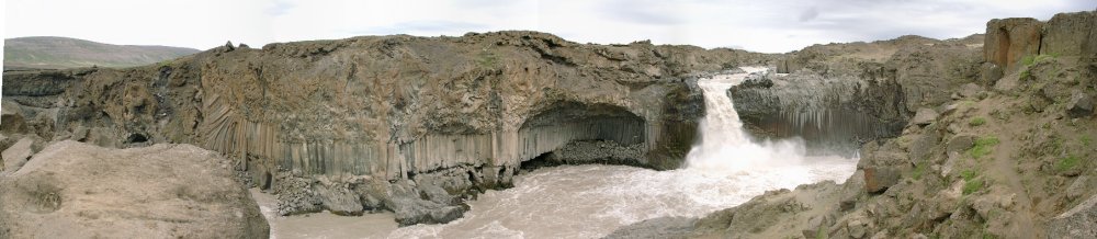
At Myvatn lake I took a look at the geothermal feature I didn't visit the first time around: the pseudocraters. Pseudocraters look like volcanoes should look but don't (at least in Iceland). In Iceland there are few 'real' volcanoes, i.e. volcanoes that have the usual cone shape. While Iceland has a lot of active volcanic areas, most volcanic eruptions come from fissures. The earth breaks open at some place and lava comes out. Around this place the lava and ash will stack up and there will be a hill around the eruption center after a while, but in effect it's like shooting an arrow at a wall and then painting the target around it.
It's not a volcano that erupts, but more a crack that builds a hill around it after the eruption. Which is why Hverfjall looks a almost like a volcano, but not quite so. And also why the Viti crater at Krafla is not on a stand-alone mountain. Krafla is a mountain with lots of magma underneath, but no 'designated point of eruption'. So on that plateau that is the top of Krafla, there are a number of craters around, basically one from every eruption that happened. But the place isn't cone shaped.
What actually looks like I expected a volcano to look like, on the other hand, isn't. The things at the south shore of Myvatn lakes are pseudocraters. What happens was the following: When Hverfjall erupted, the lava ran into the lake. Some of it came into contact with the water and the boiling water and the escaping steam the lava into strange shapes (the Dimmuborgir columns). But some of the lava managed to flow completely over some smaller bays of the lake, trapping the water underneath it (and sealing the exit) fast enough. Under this lava the water started to boil and turn into vapour and the pressure become that high, that there was basically one big bubble of air coming through the hardening lava. So it's a bit like making air bubbles in the mud, just on a vastly larger scale. But it gives interesting looking, fairly round shaped hills with a large depression in the middle. It was also one of those places that looked so much unlike anything else that it was worth going to Iceland for.
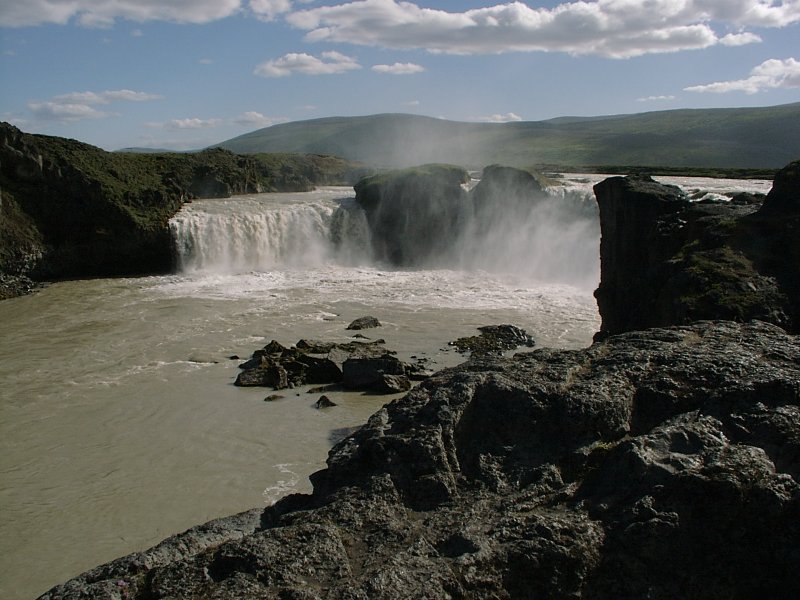
On the way back to my hotel, I passed the Godafoss waterfall once again, so I took a picture on how it looks like on a sunny day.
Next day then had a long tour.
My 'schedule' from the travel agency had a drive to Askja on it, but since it's a bit off the normal roads and I had found out by then that I didn't really enjoy driving on gravel tracks, I had booked a guided tour to Askja instead. My travel brochure describes it as this: "Askja shouldn't be missed. It's one of those cold, windy and forbidding places that set one thinking about the power of nature and who's really in charge and all that. Its difficult to imagine what sort of forces combined to create this immense 50-sq-km caldera. The cataclysm that formed the original Askja caldera happened not so long ago (in 1875), when two cubic km of tephra were ejected from the volcano making a mess as far away as mainland Europe. ... It's rather daunting to realise that such events could be replayed at any time. ... Askja has erupted frequently over the last century. As recently as 1961..." and also "The 15-hour tour is fairly gruelling by Icelandic standards..."
So it sounded like a place where it's interesting to be at. :-)
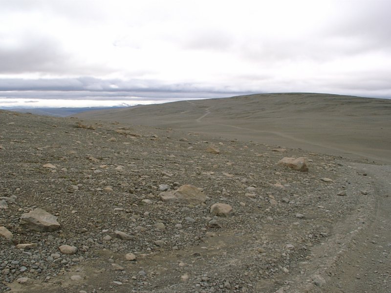
Basically there are two tour operators and I went with the smaller one, so it was just a small 4x4 bus with ten people in it. Most of the route out to Askja is rather non-descript. It takes about six hours to drive to Askja, with only the first hour along normal roads, the rest is along dirt tracks without a view.
Well, actually there is a view at about the first half of the way, since that leads to Herdubreid. Herdubreid has been described, according to my trusty travel book "as a birthday cake, a cooking pot, a lampshade and other things, but the more sophisticated tourist industry likes to call it the 'Queen of the Icelandic desert'. Whatever you see in Herdubreid's oddly symmetrical shape, you're bound to think it's a welcome view after all those km of desert you've crossed to reach it." Which pretty much sums it up.
There's a some grass growth around Herdubreid and to quote the tour guide: "If you like anything green, have a good look around. That's the last vegetation you're going to see until we come back here in the evening."
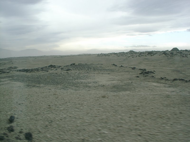
After Herdubreid it started to get dull for a while. Just look at the next picture for two hours and you get a reasonable simulation of the experience.
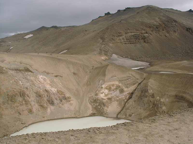
Then you drive up most of the side of the caldera, walk a couple of yards over the rim and then continue for about twenty minutes along dark gravel with red (iron ore) areas in it to the interesting parts.
Which are two lakes.
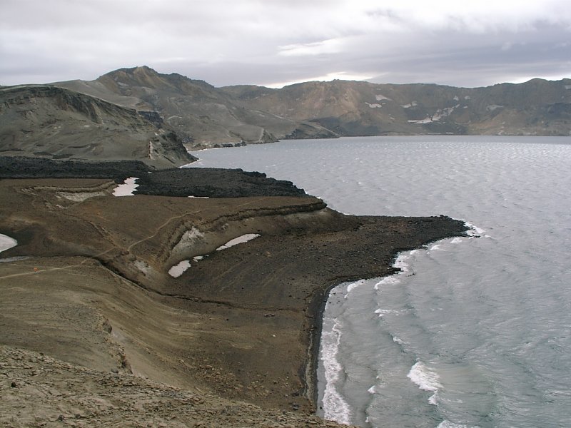
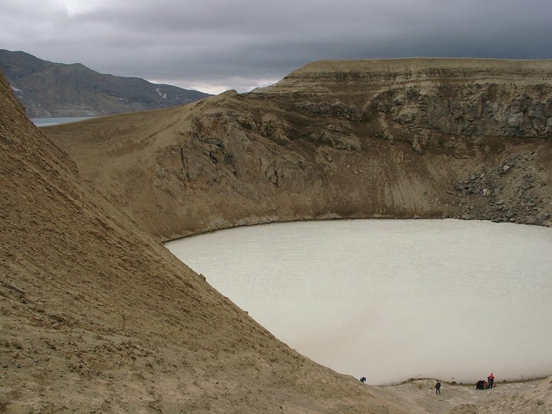
The larger one, Oeskjuvatn, is deep blue and icy cold. The smaller one is a bit down a crater and looks a bit like something coming out of the back side of a chemical factory. Some milky white, suspiciously smelly fluid. This is sort of the 'main attraction'. Back to my travel guidebook again: "Also in the 1875 eruption, one particularly active vent near the north-eastern corner of the lake exploded and formed Viti (not to be confused with Viti at Krafla), a tephra crater that contains a hot lake. It is, incidentally, an ideal temperature for swimming if you're so inclined. The route down from the rim is quite slippery, however, and some people are put off."
Our tour guide also advised us that taking a bath here would be the proper thing to do. He also mentioned that it would be best to do it the 'Icelandic way', i.e. nude. His reasoning was that the water there contains a lot of sulphur and it's near impossible to get the smell out of the bathing suit afterwards. And since the water is milky white, there's nothing to see in the water. And to change into swimming trunks, we had to undress anyway, so we might just go into the water directly.
It was a rather strange experience on a couple of counts. First of all, it was quite windy, so walking along the rim of the crater we looked a bit like a company of mimes on their annual work outing. Then some of us climbed down the crater wall. There's one point where you can walk down the sandy slope, but you have to be careful, because the 'beach' (i.e. the small sandy part where you can stand next to the lake) is directly beneath that and there's lots of loose rubble, so you have to take care not to unleash a small avalanche on the people below you.
The temperature was about 55 F, which was ok, but due to the wind it felt colder, so I undressed quickly and went into the lake. Oddly enough (or maybe not) only four of us went for a swim, the rest declined. The water was comfortably warm, though it felt odd in the places were you could still stand, since the ground under the feet was a bit like a sandy beach, but warmer than the water. A lake with underfloor heating. And this was the point when I realized that I was basically standing on the surface of an still-active volcano and that there's probably molten lava not too far down below my feet. And that, if Askja decided to break out again, I'd probably arrive in Berlin a couple of days earlier than expected, albeit not in one piece.
It was a strange place to swim in. Fairly alien. And swimming into a rock made it even weirder. No, not an underwater rock, but a fist-sized piece of rock swimming on the surface.
The reason for this was that pumice stone comes from volcanic origins and it's lighter than water, so some of those stones just happen to float on the lakes. Odd sight. And it turned almost surreal when I looked up.
Because in the meantime the bus from the other tour operator had arrived and it seems like their tour guide didn't tell them about the wonderful bathing opportunity here. :-) So I looked up, and along the rim of the crater were about 30 people, all in semi-polar gear [Gore-Tex jackets, windbreakers, sunglasses, wooly hoods and all that], standing in strong winds, obviously feeling cold and looking like creatures from another world, looking down at us four who were bathing in the lake, pulling out their cameras and taking pictures of us 'weirdos' down below. Suddenly we were the main attraction. The contrast between lying in the warm water an those windswept figures above us was just eerie.
All in all, one of the experiences you go on vacation for. Completely unlike anything you've experienced before, strangely satisfying and something that you wouldn't want to do around people that know you. :-)
The name of the crater, Viti, means 'hell' in Icelandic. So I (literally, but not figuratively) swam through hell and back again.


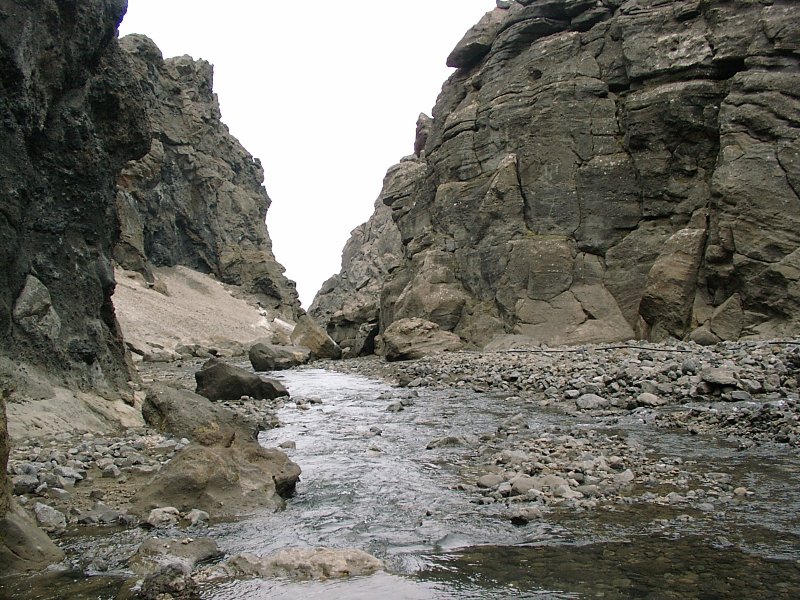
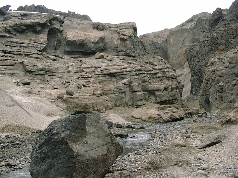
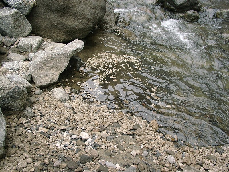
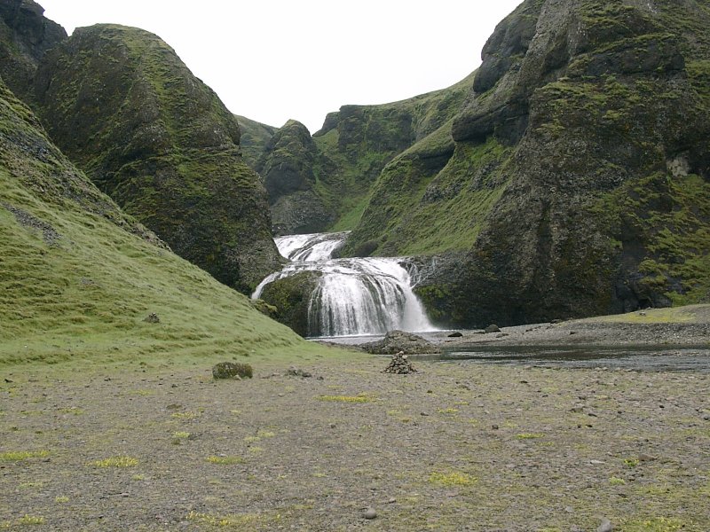
On the way back we stopped at the Drekagil gorge, which is at the side of the Askja caldera. According to the travel book it "resembles something out of Arizona or the Sinai; the habitually bitter winds and freezing temperatures just don't suit this sort of landscape!" Don't know about Arizona or Sinai, but the thing I found most interesting about that gorge were the stones on the river. The river carries lots of small pumice stones from the caldera and it is a rare sight to see bits of stones bobbing in the eddies of the stream.
Having seen all the most interesting sights in the north of Iceland, next day I had to head south again. I had to go there on the longest of the interior tracks, the Sprengisandur route. I toyed with the idea of skipping this part altogether, because Iceland isn't that large and going along the ring road would have been just about 200 additional miles. Given the slow speed that you have to go on the inland tracks, I might have even arrived earlier. But actually that hadn't been a choice anyway, since my travel agency had booked me into Versalir that night, which is known as Icelands most remote farm and lies about three quarters down the Sprengisandur track. So to get there, I had to drive down the 4x4 track.
To my surprise, it didn't bother me much. I guess that's partly because I knew what to expect. On the way up, I had expecting interesting sights and overwhelming landscapes. Which weren't there. And I did think that driving 4x4 would be enjoyable. Which it wasn't.
But now, especially since all travel guides had the Sprenginsandur track down as 'mostly dull', I didn't expect much anyway. So just sit down in the car and roll away the miles. No problem.
There was an attraction after the first two hours drive.
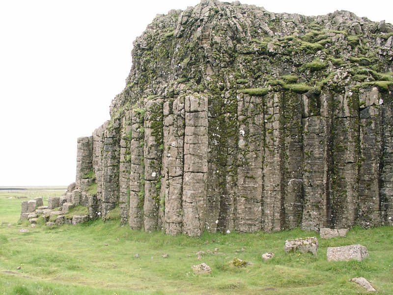
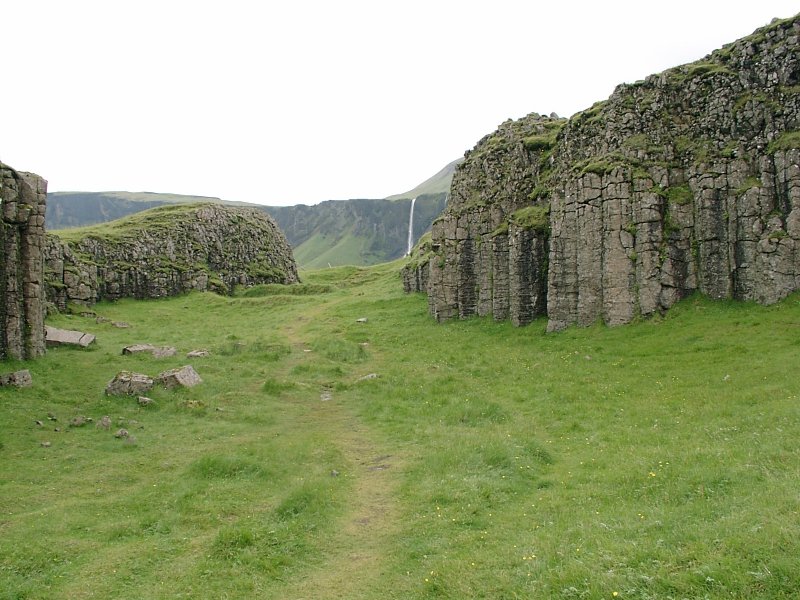
The Aldeyarfoss waterfall. Maybe not one of the worlds ten most beautiful
waterfalls, probably not even among Icelands ten most beautiful waterfalls,
but in an otherwise dull scenery, it's a welcome diversion.
And with all those grey basalt columns, it does look strange.
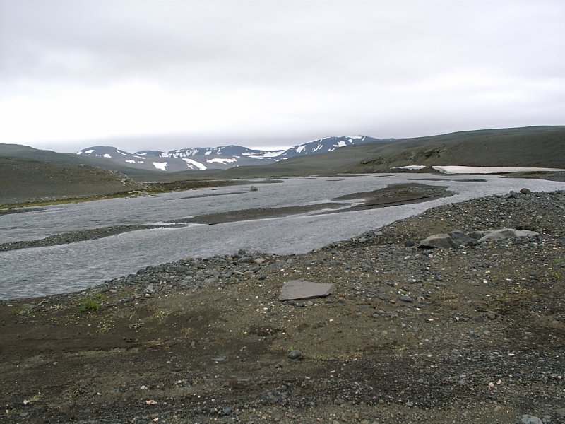
So after the waterfall, it was another two hours drive until things got interesting again. The road ended at a river. And continued on the other side.
My first river crossing in a car. Naturally I was worried. I had never done that before. My car rental contract was very specific that damages that happen during river crossings are not insured. The river had glacial water, so it was muddy brown and there was no way of seeing how deep it was and how many rocks it carried.
When I was on the bus tour to Askja, there were two river crossing (which were slightly easier) and I watched how they did it. Basically you don't go the direct route, but you drive downstream to about the middle of the stream, then turn upstream to drive out. I had read all the special sections in the guidebooks that explained what to do and what to avoid.
So I knew what to do. I waited.
After about half an hour someone arrived from the other side. They stopped, got out of their car, walked up and down the river bank and tried to figure out a plausible path. I had done the same from my side, but didn't see anything convincing. So we stood there for another 20 minutes on opposite banks, looking confused. Then they went back into their car, drove into the river and came out on my side.
So I memorized the path they had taken, started my car and drove into the river. Went in fine, got to the middle, turned upstream, still reversing their path and didn't move forward. Unfortunatly rivers aren't symmetrical, and their bank was steeper than mine. So they could get in on their side and out on mine, but I could get in on my side, but not out where they came in.
Deep, deep trouble.
The car stuck in the river, about two feet deep in water, the river almost up to my car window and I can't move forward. That's not a good moment to find out that the interior of the car is not waterproof and the water is starting to rise in the car.
I'm near panicking. I'm just getting very aware that I'm in the middle of nowhere in the middle of a river, stuck in a car I'll have to pay for if I can't get it out again.
I don't know how long it actually took, I guess not more than 30 seconds all in all, but that were some of the worst moments I had for years.
The only good thing about that all is that the motor kept running. Once the motor starts stops, there's no chance at all of getting it running again. Since I can't go forward, I go into reverse and luckily, very luckily I manage to get out again. Not quite back to the river bank, but to a 'sandbank' close to it.
So I stop the car, open the doors and let the water run out. I sit back an worry. I feel fairly lucky that I came out of this and I'm not really willing to push my luck and try again. But then, there aren't many alternatives. So I wait. A short time later a car arives from 'my side' of the river, seems to wonder a bit about me standing on the sandbank and then drives through, getting out about ten yards higher upstream than where I tried. So I follow his route and this time get out on the other side without any problems.
I drive on. Soon, some warning light comes up on the dashboard. Engine trouble. But the engine keeps running. I stop and take a look at the motor. Not surprisingly, it's fairly wet at some places. I wipe off the most of it and drive on. I hope the motor will dry off when it gets warmer and the light will go off again.
No such luck.
The engine runs as long as I step on the gas pedal, but once I let it go idle, it stops almost immediatly. So I can switch gears if I am fast enough, but I can't just step on the clutch and let the car roll without the engine stopping. I don't mind too much, uphill it's no problem, since I have to accelerate anyway, and downhill I just let the engine die and release the clutch when I'm at the lowest point. The speed the car has is sufficient to restart the engine again. Inconvenient, but managable.
I drive like that for 10 miles or so. Then I get to a downhill bit that's a bit steeper than the previous ones, so it's not straight, but goes down in a sort of serpentine. I go into neutral gear, the engine stops and I just roll down. Since the car speeds up a bit, I hit the brakes. The car doesn't slow down.
I hit the brakes much harder and also use the handbrake. The car stops. The power brakes work only while the engine is running (and a couple of seconds after that). Once the engine has stopped, you have to brake a lot harder. Not a comforting thought.
So for the rest of the day (actually most of the rest of the week) I don't go in neutral gear anymore (or press the clutch longer than necessary for changing gears) and just brake and change to lower gears when I have to slow down. No fun to drive that way.
Fortunatly the other two rivers are a bit easier to drive through.
Somehow I make it to the Versalir farm. I have dinner and go to my room, reflect on the day, fall in a gloomy mood and go to sleep.
Next day the engine hardly starts and still dies when it is put in idle. Originally my travel schedule says to drive via Landmannalaugar (which is along another interior 4x4 track) to my next guest house, but I don't want to take this car along tracks anymore, so I ask for the shortest track toward an asphalt road and the nearest car repair.
Finally I arrive at Hella, the little village that is supposed to have a car repair. But it's late Saturday afternoon and I'd have to wait to Monday. So I'll have to drive on with a defective car. Not good.
That fortunatly ends the depressing bit of the vacation. After that, nothing serious went wrong, the car damage didn't get worse and I managed to drive around for a couple more days before bringing the car back to the rental agency.
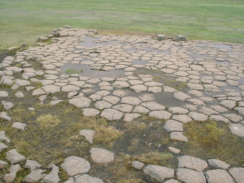
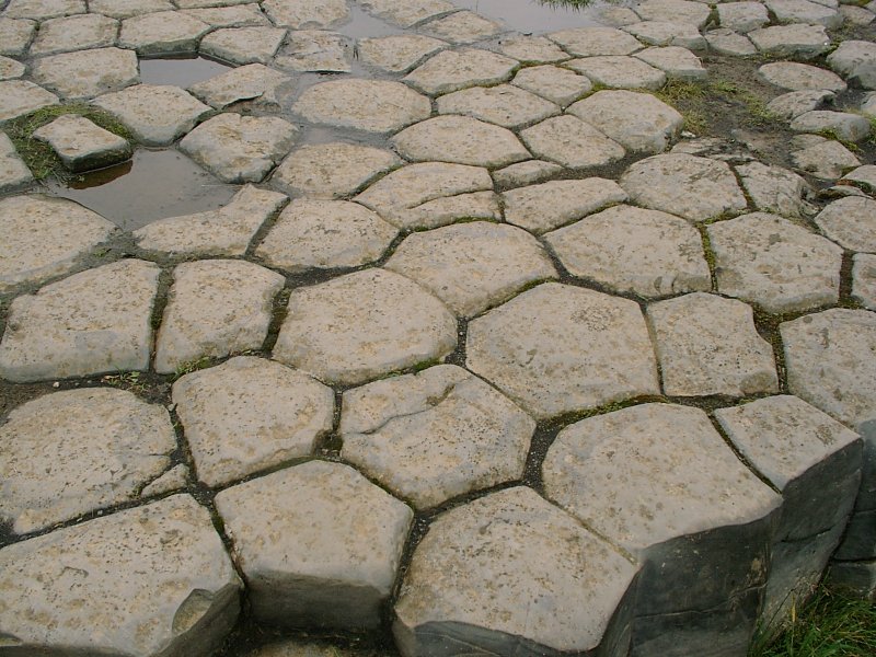
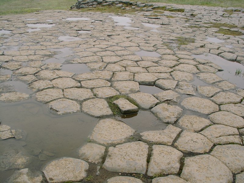
Next day I drove to Kirkjubaejarklaustur, which is worth mentioning, just because it's likely to be the most difficult Icelandic village name. The attraction here is a small area that looks like a tiled floor. It's a roughly rectangular area, about ten by fifteen yards and it looks artificial. Actually artificial enough that early settlers thought that these were the remains of an even earlier settlement and assumed this was the floor of an anchient church and named it Kirkjugolf (meaning church floor). In fact it's a natural lava formation, sort of like the pattern that mud has when it dries in the sun, just with lava instead of mud.
Another attractive non-attraction is three hundred yards further on and is another waterfall (actually more like a water cascade than a fall). This one is called Systrafoss. Basically I liked it because it is just there and nobody really cares. South Iceland has so many picturesque waterfalls, most tourist can just cover the more famous ones. So there's always the odd little waterfall that you've got to yourself.

Next short stop on the road was Dverghamrar. Which basically means 'Dwarf hammer' and was caused by basically the same geological effect as Kirkjugolf. But it looks indeed a bit as if some dwarves have started to hammer columns out of the rock (and it must have been dwarves, because the upper part of the rock is not touched :-)

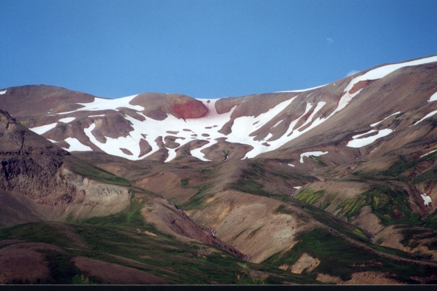
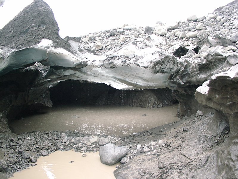
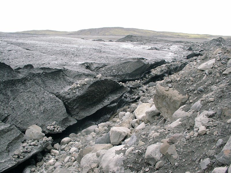
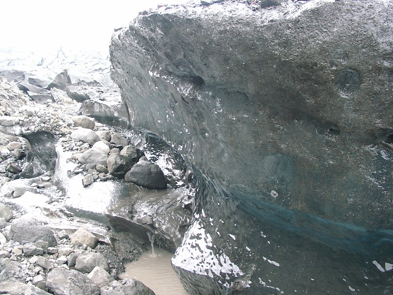
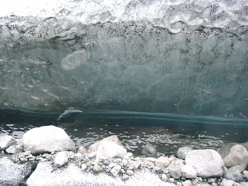
Then it was finally time for some ice. It is called Iceland after all, and I haven't seen any serious ice so far (just some small snow fields on mountain tops and in Askja).
But for some ice in the south, the best places are the glaciers. And Vatnajoekul is the biggest of them. I drove to one the glacier tongues. When the sun was right, you could see the deep blue glacier ice underneath the snow and the dirt and the rubble. Basically glacier ice is always blue, but once it gets near the edge of the glacier, the glacier movement causes microscopical cracks in the ice and these cracks and the air getting into them make the ice look white (at least underneath the dirt).
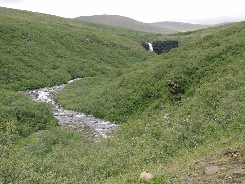
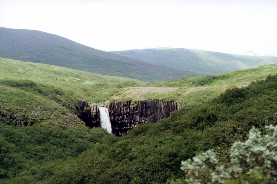
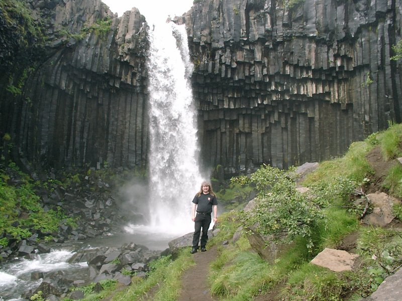
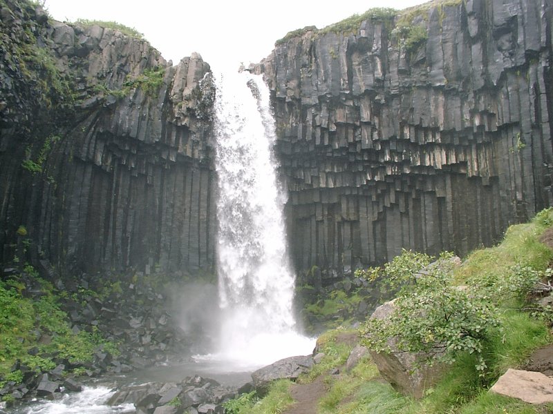
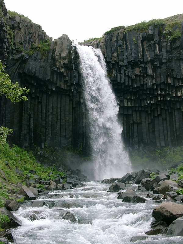
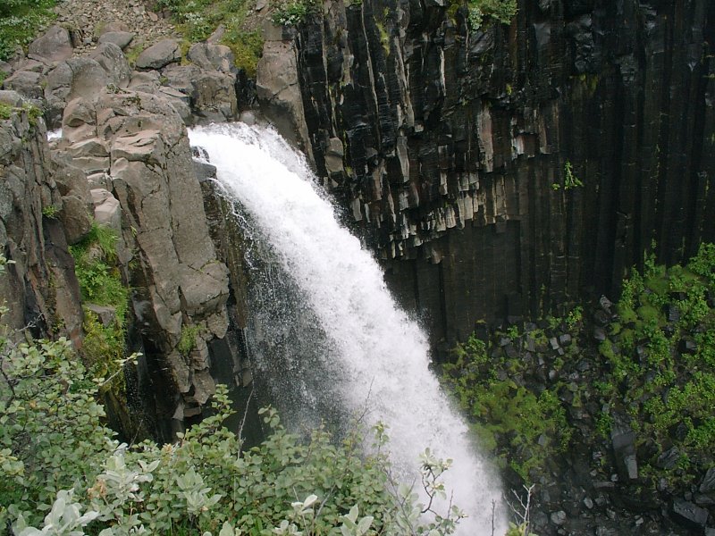
An hours walk away is (in my opinion) the most beautiful waterfall in Iceland. It's called Svartifoss and it's a waterfall running over a dark basalt column formation in a green forest area. It's an amazing contrast between the lush green bushes, the dark black basalt columns and the white spray of the waterfall. It looks very 'sculptured'.
For a while even the sun came out, so I went very close to the waterfall and got wet all over. Sometimes it's fun to take a shower while having your clothes on. Later I went up to the top of the waterfall. There's no path to that, so I had to make my own way through the 'woods'. Not much of a problem. To quote one of the most overused 'riddles' about Iceland (every tourist brochure seems to use that, so why shouldn't I?): "What do you do when you are lost in an Icelandic forest?" "Stand up."
Still, it was great to walk up there, since hardly anyone seems to do it. On the lower end of the waterfall, there were a lot of tourists (which means in that area of Iceland about five to ten), but up there I was alone. The view from the top was neat.


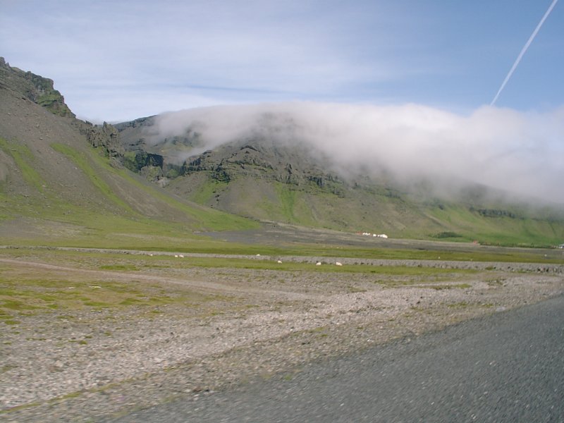
On the way to the next guest house was a nice view of the evening fog coming over the mountains.
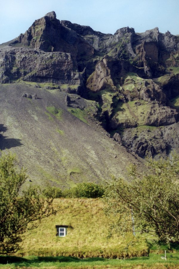
And in the small village where my guest house was, there was something looking like a grassy mound, which turned out to be a church overgrown by grass. Originally built in the 1300s it was rebuild in 1884.