

Campinas doesn't seem to have any big tourist attractions.
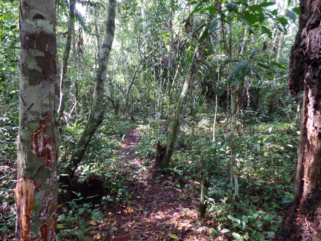
There's a small exploration of science museum on the campus of the university. But that turned out to be more like a science exhibit space than a museum - there was a new presentation announced for about two months later, but when I was there only the permanent outdoor exhibition was accessible.
It has a few nice things, like a gnomon with a large ceramic earth model, but most of them aren't in a good condition.
For example, there is a large turntable with a many compasses on it, but if the lesson is that all compass needles point north, regardless on how the compasses are turned, it's a failure.

The needles point pretty much whatever way they like and the only scientific lesson (a valuable one, but probably not the one intended) is that scientific instruments are only useful if they are properly maintained.
Unfortunately I couldn't read the Portuguese info table next to the tablet. It would be cool if that actually would be the lesson on it, but I doubt it.
So there's not much to see or to learn at the university science museum. There's a reasonable view over to downtown Campinas and the surroundings, but in the end, the most interesting feature was a 'punk' looking bird nearby.

But there is something interesting to do about 150 km away and that's where I was heading.
Unfortunately, my navigation system made getting there more difficult than planned.
I had looked up the road to Pedra Bela on Google Streetview before travelling to Brazil and noted that it was a nice new road. It should have been an easy drive.
But it is a tiny bit longer than another route.
I enter my destination into the satnav, but fail to notice that it used a different route than the one I had looked at earlier.
And that means about 20 km of sand, gravel, washboarding surfaces and dried mud to drive on, and, at one point, a tree lying halfway across the road.
Easy for 4x4 vehicles. But with the small, cheap, rear-wheel drive rental car I had, while manageable, it was no fun. It took me about two for those 20 km.


(And the pictures show only the nicer bits - I had to concentrate too much during the crinklier parts to think about stopping and taking a picture.)
And the car smells kind of funny afterwards - likely the smell of a nearly burned clutch disk. (Luckily the smell was gone by the time I returned the car.)
In the end, the shortcut had, at best, shortened the trip by about three kilometers.
But I get to Pedra Bela in the end.


Pedra Bela is a small non-descript village pretty much nowhere (even people in Campinas, only 100 km, away hadn't heard of it).
It's among some nice, green hills and it's a pleasant place, but that's not enough of a reason to drive there.
The reason to drive there is its zipline.
And an amazingly long one.
Take a look at the second of the Pedra Bela images above.
Where the photo is taken is more or less where the zipline starts. And the large group of houses in the middle, that's Pedra Bela, is where the zipline ends.
So it's a long ride.
Probably the second longest in 'The Americas' (it seems like there's a longer one in Peru). According to their info, it's 1900 meters long, according to my GPS, it's about 1700 meters. Actually, both might be right, as my GPS gives distance on the ground, while they might be measuring the length of the cable. Since the altitude difference is about 180 meter and there's some slack on the rope, that matches quite well.
Originally, I had planned the first day only as a travel day, but even though I arrived a bit later than expected, I was still in time do one ride on the same day. (Which was already a convenient luck in timing that they operated at all on that day - the zipline only runs on Saturdays, Sundays and public holidays. But as this was the Easter weekend and Good Friday is a public holiday in Brazil, the zipline was open.)
So I went to the ticket booth and managed to get into the group after the one that was just getting ready.
They put me in the climbing harness, clipped the ropes with the zip line trolley (essentially a pulley, but with two wheels) to the belt and wait for the bus.
For safety reasons, I also needed to put on a hair net and a helmet. (Both seemed a bit pointless - if anything goes seriously wrong, a helmet won't make any difference. And as you're ziplining, not climbing, it's unlikely that something will drop on your head. And while a hair net makes sense for some ziplines, as you don't want your hair caught up in the trolley wheels - if your hair jams the wheels halfway down the cable, it's a long way down and a long way away from help - you hang about a meter below the zipline, so it's quite unlikely that your hair will fly that high. But anyway, hair nets and helmets are mandatory.
After a while the bus comes back to pick up the group and drives you up most of the hill where the zipline starts.

Most of the hill.
There's a big rock on the top of the hill and the bus can't go there, so you need to walk the last bit with all your gear. (Note: Climbing gear is not really good for walking.)
There's a small church on top of the rock, so there are proper stairs leading up, so it's not as if you need to climb the rock (btw, you can, there are climbing routes along the rock, but not when you're going ziplining), but it's still a fair way upwards (about 50 meters, about a 15 story building stairs to walk up).
But once up there, the hardest part of the ziplining is already done.
After that, someone clips your trolley on the cable, makes sure the previous person arrived on the other end and unclips the blocking rope. Then you walk or run down a flat bit of rockface until your feet no longer touch the ground. And you're off!


There were a few people going down the line before me and then it was my turn to step up to the cable.

I am not quite sure why there are two cables going down - the second one is not in use. It has a couple of aviation highline obstruction markers on it, so it may just be a legal necessity to mark where the cable is - and it would be quite impractical to put it on the cable that is used. Maybe the second cable also has some use in case of a rescue operation in case someone gets stuck on the cable halfway, but I can't really see how this would work. The markers also seem to serve as photo markers. They take pictures of people on the zipline and they all seem to be taken close to the marker balls on the second line. So they might have marked the setting on their lens to be in focus when someone is next to one of the markers. But I doubt that this is the reason for the second cable, more a useful side effect.
In any case, after a while everything is ready, you get your 'go' signal and get going.
And enjoy the view on the way.

High above the trees...

And that's the end of the (zip-)line.

The stretched out bit of old rubber tire visible there is only the final emergency brake (if at all - at that point the cable is only about 50cm above the ground, so, if you were still going at speed, you slammed into the ground a couple of meters before reaching that). The real breaking system is the guy sitting under the small grey umbrella about twenty meters away (difficult to see in the picture). He has a rope connected to a wooden square that is hanging on the cable. If someone comes down the cable, the trolley runs into the wooden block and the guy uses a rope to slow you down, so you are at walking speed when your feet reach the ground again. Then someone else unclips you from the cable, the wooden square is moved back into the original position and the guide at the top of the rope is told that the cable is free and the next one can take a ride.
As expected, the ride was fun (it would have been disappointing to go through all this effort of going there and then find out it wasn't), but it was also the last one I managed to get onto that day, since, by the time I was back down again, they didn't take any more riders for the day. Still, as I hadn't planned on ziplining on that Friday, it was an unexpected bonus to be able to do it at all.
So I headed on to a pousada, where I was staying for the next two nights.


Checking the GPS trail of the zipline ride, I was surprised about the speed.
The web page stated speeds up to 107 km/h and I was a bit doubtful about that. I assumed that would be true for some expert with specialized equipment, freshly oiled trolley wheels on the cable, an aerodynamic suit and some special body position to maintain. And that a normal customer would not even reach half that speed.
But even though some of the GPS speeds measurement are obvious outlier data points, the overall speed curve pretty much shows that the top speed was around 95 km/h, which is surprisingly close to the 107 km/h maximum, given that I wasn't doing anything special or having any special equipment.

Speed is shown km/h, distance is shown in meters.
And the next day, which also had slightly better weather, I did go back and do it again.


This time I was more relaxed and could enjoy the scenery a bit more.


At the highest point, you are hanging about 130 meters (about 400 feet) above the ground. (I'm still not sure why this didn't worry me. I am not that comfortable with heights - just today I was standing in a concrete tower that was less than 10 meters high and I felt distinctly queasy. I have no idea why standing in a massive, solid tower makes me uneasy, but being suspended on a rope from a cable hanging 130 meters above the ground and moving at a high speed doesn't. A ballooning guide once told me that few people have problems with heights in balloons, as there is no visible connection with the ground as there when standing on cliffs or observation towers. There might be something to it.)
Once I was at the end of the cable (which takes about 2 minutes, giving an average speed along the cable of around 55 km/h or 35 m/h), I went back to the counter and got in line for the next one.
Conveniently, there was someone there who spoke English, which made the whole thing much, much easier. I can usually get along in Brazil with miming and pointing, but if there are some security instructions involved, it's better to be sure you understood them all. It happened to me once in Belgium, when, at the end of a (much shorter) zipline someone urgently shouted something at me in French. Only after I hit the crash pad at the end, I found out that he was telling me to hit the crashpad with the feet, not the back, as there was a big rock right next to it. And if you want with your back first, there was a chance that you would partly slam into it. Nothing happened, since I did hit the crash pad pretty much in the middle - but it's better to get safety instruction in a form you understand.
One thing I wasn't sure about, for example, was whether you should grab the rope that holds the wooden 'brake block', as I wasn't sure whether that block was just to slow you down or whether they use the rope to 'pull you in' if you don't quite make it to the end of the line. Or, worse, that the cable might hang through a bit and, if you don't grab the rope, you slide back on the cable.
Turns out that you don't have to grab the rope (but if you do, it doesn't matter).
When you arrive at the braking point, you still got a fair amount of speed (roughly 40 km/h), so the braking is quite helpful. It's not the speed at which you want to hit the ground.

Here the brake block has already caught, so the top end of the rope is already slowing down, while I'm still moving forward a bit.
On the first runs, I had an action camera tied to my leg. (Quite noticeable in the image above.)
On the next run, I was more comfortable that there wouldn't be any sudden jerks on the rope (except for the one right at the start, since then the rope still has a bit of slack in it and once your feet leave the rock, it pulls tight), that I wouldn't mind not holding on to the rope and that I wouldn't drop the camera for any reason, so this time I held the camera in the hand. Which is the reason for more pictures of me on this run than of any other.
It also allowed me to take a picture of the view along the cable, which is hard to do when the camera is tied to your leg.

Almost ready to go now, but the safety rope is still clipped in.

And down the line!

Some more pictures down the way...


Or, as seen from the end of the zipline...


And, as the camera was running anyway, here's the video clip.

(The clip is 78 MB large and lasts about two minutes.)
There are a couple of unintentional whip pans in the video - it's difficult to control the direction that you are facing when you are on the zipline.
On the first runs I tried to turn by swinging my hands and arms around, but that barely worked. Someone also told me to just hold out my hand as a sail, so that the wind would turn me around. That didn't do much either.
What actually did work was to pull your knees up. While I have no idea why that should work (since that doesn't give you any angular momentum), it somehow does. (Maybe it twists the climbing harness, which then twists the rope you are hanging on. But that seems like a feeble explanation.)
In any case, bringing up your knees is much easier if you don't have a camera zip-tied to your leg.
So I was able to turn around on the rope, but that wasn't well controlled, hence the somewhat abrupt camera movements.
Afterwards I went down to a street underneath the cable and looked at people flying across the skies above me.


Not all people arrived at the zipline site with a car. Some had chosen another sort of transport.

The ziplining was a lot of fun and worth the detour from Campinas.
Realistically, you can only plan for a ride every two or three hours. When you buy a ticket, in most cases you will be in the group after the next or one later. And every groups takes about half an hour (as there are about ten people per group and everyone 'blocks' the cable for about three minutes before the next can have a go). So with two groups to wait for, you'll be on the bus about 90 minutes later, then the bus ride up the hill and the walk up the rock and you'll be on the starting point about two hours later. And then, depending on where you start in the group, it might take up to another half hour until you're on the way down.
It's surprisingly pleasant, as there's a cafe and ice cream place next to the ticket place, so it's not like you have to stand in line for an hour. You can have refreshments, just relax in the shade or watch people coming down the cable. And after that you are busy anyway, with getting kitted out, going on the bus and taking the stairs up the rock. So you don't spend the time just waiting and getting bored. It sure beats standing in line for rollercoasters.
Another thing that surprised me is that they have a "kid's option". They don't have any age restrictions. As long as you weight more than 40kg and less than 150kg (and, if I remember correctly, a height of 1.40 meters) you can ride the zipline.
But I've also seen kids do it that were at best five years old.
While they can't ride alone, they can ride with a parent, as there are special iron rods for that purpose. The rod is attached with two trolleys to the cable and the kid is clipped in on one end and the parent on the other, so they can ride together. I had never seen that construction before and I was quite impressed by it.
Next day it was already time to drive back to Campinas and catch my flight south. And this time I made sure that the navigation system picked the slightly longer, but much easier route along the proper road.
The main attraction there are, of course, the Iguaçu waterfalls.
And they are impressive.
Really, seriously impressive.
It's also a bit like a waterfall exhibition, giving you samples of all kinds of waterfalls.
There is a big, truly massive waterfall...

...there are also 'curtain' waterfalls...

...waterfall cascades...

...thinner, spouting waterfalls...

...gorge waterfalls...

...and also a waterfall related phenomena, like mists...

...and rainbows.

Lots of rainbows.


If someone would try to make a 'best of waterfalls' collection, it would pretty much look like this.
All in all, there are supposedly 275 waterfalls. Although I couldn't find any clear definition what 'one' waterfall is.
How much separation do they need? Are these one or two waterfalls?

And these? Two waterfalls? Or is the one to the left three waterfalls? And what about the small trickle down the rock at the top of the left waterfall. Does that count as a waterfall too?

And what about cascades? Do they count as individual waterfalls or just as one cascading waterfall?
It's probably complicated. I once read the (or, given that it's geology, 'a') definition of a mountain, i.e. when is some elevated point considered to be just a subpeak of a mountain and when does it count as a mountain of its own?
That definition was already somewhat non-intuitive. And a common definition of "what is a moon" is even more so.
And moons and mountains are quite permanent.
To define something as, well, fluid as waterfalls, is a lot harder. (And likely a lot more open to interpretation.)
But 275 is the official number of waterfalls.
And by any count, that's a lot.
I was staying at a rather fancy hotel on the Brazilian side of the fall.


The big advantage was that the hotel is located within the national park that surrounds the waterfalls, so it was close to the waterfalls and I didn't have to get there from some outside hotels (it's about 12 km drive from the entrance of the park to the waterfalls).
It was also quite convenient as you get to stay in the park after it is officially closed to visitors, allowing you to have a nice evening or morning stroll and have the place pretty much to yourself.


Which gives the place a different feel than later during the day, when it looks like this.

It also allows you to see some of the slightly shyer animals that come out to do some scrounging in the morning, but stay out of sight when things get too busy, like these agoutis.


Although it doesn't give you any advantage on seeing coatis (a sort of raccoon).
They are quite prominently not shy.


In fact, they are a nuisance.
They not only 'beg' visitors for food, they pretty much just grab stuff and run with it.
And, like the stuff on cigarette packets, the warning signs in the park go from simple prohibition sign such as this...

...to somewhat more graphical warnings.

They look kind of cute though when they are feeding on something else than stuff from the waste bins, packages of cookies and candy bars they grabbed from someone. (Even though this coconut surely was somebodies drink container earlier on.)


In any case, I ignored the coatis, they ignored me and I had some nice views of the late afternoon sunlight streaking through the mist of the falls.


I had planned to go on a 'full moon walk' later that night, but there were some clouds coming in during the evening, so the walk was cancelled.
As that was the last night of the full moon during my stay, there weren't any other night walks while I was there.
In theory, I could have just walked to the waterfall on my own during the next evenings. While not technically full moon, there was still enough moonlight, so it wouldn't have made much of a difference.
But some people told me that they had done the walk on their own and it was great, while others told me that it is strongly discouraged. And anyone found wandering around by park personell will be kindly but firmly escorted back to the hotel.
In any case, I didn't try, so I don't know.
Next morning it was time to get seriously wet by taking a boat and seeing (some of the smaller) waterfalls from below.
The boats were large inflatables with lots of seats.

The ride starts a fair bit downstream from the falls. It then crosses some minor rapids, provides some views of the smaller waterfalls and finally going through one of the smaller ones.


When going through the waterfall (or close to the spray of one), you get wet. Very wet.


I had brought a waterproof camera and as there were drops on the lens, I tried to wipe it clean on my jeans from time to time. That resulted in a picture showing quite clearly how wet it was. It's not just that the trousers are soaked, there's even a layer of water on top of them.

Of course, everyone else on the boat (a group of Chinese tourists) was wearing protective clothing, while I was just sitting there in jeans, t-shirt and layers of water.

Of course, I enjoyed the trip and it was warm enough that I didn't really care about getting wet.
Then there was a short trip over the rapids again, the down calmer sections and back to the starting place.


Of thing I did see, but failed to notice its significance at that time, were some twisted bits of metal on the shore.


When I looked at possible things to do in Iguaçu, I did see pictures of people rappelling at guaçu. The rappel itself did not seem that exciting - just go down a straight, free hanging rope. But the pictures with people hanging on the ropes and the waterfalls in the background looked amazing.
But it turned out that the company wasn't active anymore and there was no more rappelling in the park.
As the company was in charge of all the 'action activities', that also meant that there wasn't an option to do any rafting in the park either.
The reason for the closure of the company was not that there was a lack of interest, mismanagement or an accident - the reason was that there was a huge amount of water coming down the waterfall in June 2014, causing high water levels downstream and the rappelling tower got fell down in the floods.
And that's now the pile of metal on the shore.
After a quick lunch and another walk on the viewing path to see the waterfalls at noon, in the afternoon it was time for the "Black Well Trail".
The activity looked good on paper, but the reality was - kind of ok, but not much more.
The tour is an 'Ecological Safari' that starts down a track through the forest, followed by the crossing of a suspension bridge to an observation tower with a panoramic view over the forest. Then a boat ride, passing 'Parrots Isle' with, supposedly, flocks of thousands of parrots at sunset, an optional ride in a kayak and then walking back along the (shorter) Banana Tree Trail with "small ponds", "aquatic habitat birds" and "exuberant vegetation" might be spotted.
Sounds like a good way to get a bit of everything.
There were three clients and one guide on out tour, the last of the day.
And at the beginning, there was one decision to make: How to go down the track?
There are three options - hike, bike or take the jeep.
As that was the only activity the three of us had planned for the day, all of us were staying at the same hotel (so there was no need to head somewhere else after the tour or catch the last bus out of the park) and all three of us were reasonably fit, we decided on walking the nine kilometers.
That was also the option that seemed to have the best chance of spotting some wildlife. Taking a jeep seemed a bit like cheating anyway (book an excursion on the "Black Well Trail" and then use a car?) and bikes seemed nice, but also a bit less of a sightseeing option.
So walking it was.
But if walking down a trail in a subtropical rainforest sounds adventurous - well, it isn't.
Because, at least for me, a 'trail' implies something a bit rough with a bit of variation and adaptation to the local nature.
This trail was a sand road cut through the forest.


And, actually, a nicer one than some bits of the road I took to Pedra Bela.
As an alternative to biking, they might as well offered skateboarding as an option.
Of course, if it had been a rough track going through the forest (like the one I'd been on in the Amazon), it might have taken us four hours to cover the nine kilometers, while it took us almost exactly two hours.
And we spotted (but failed to photograph properly) some Capuchin monkeys in the trees.
")
Some agoutis were also on the trail. (Although just getting out of the hotel in the morning and seeing them there seemed the better option.)

As well as some 'ant volcanos' on the track itself.


And the vegetation on the sides of the track looked quite interesting in places.


When we arrived at the river, the guide called the boat.

We didn't go over any suspension bridge or to any observation tower.
I assume that there was a timing problem. We were on the last tour of the day and while it was still bright and sunny, sunset was only about an hour away.
So we got on the boat went along the shore until we spotted a caiman, but got too close to fast, so the caiman had moved into the water before we could get a good picture.


Then we rushed by the 'Parrot Isle' while getting a short info about the large amounts of parrot there. As, supposedly, there are thousands of them and they flock at sunset, it would have been a good time to get closer, slow down and observe them, but were rushing to the next part, the kayak ride.
That was nice, relaxing and fun.


As long as you ignored that you were in a small inflatable boat and you've just seen a large caiman moving into the same river.
It's unlikely that a caiman would ever attack, but it adds a certain frisson to the ride.
In the meantime the guide, who stayed on the powered boat while we were paddling, had spotted a toucan at the shore. We didn't see it in our boats, as we were farther from the shore, but at least the guide took a picture.

We paddled about two kilometers before we went back to shore of the Iguaçu river.
We then just rushed back the "Banana Tree Trail" to the main road while the guide was calling in for the shuttle bus. I've no idea whether there is any banana tree (or "small ponds", "aquatic habitat birds" and "exuberant vegetation") near the trail - we were just rushing along.
All in all, it was an "ok" afternoon. It was a nice walk, the paddling was nice, the sun was shining, the scenery was gorgeous - but it all felt like rushing through some checkpoints.
I am not sure whether it would have been better if we had taken another option at the start.
If we had taken the bikes, we would have had at another hour, probably more, at the end of the first trail, which might have given us the time to go to the suspension bridge and the observation tower and still have more time for the boat trip, and maybe seeing more caimans and parrots.
I suspect that the upcoming sunset was the main reason for rushing through things. But they do these tours every day, so they should be aware of how long the trip takes. And maybe inform visitors that going for the 'walking' option does not just add the effort of walking to the trip, but also has a negative effect on the things that come at the end of the trip. Or only offer jeep or bike as the only choices on the last trip of the day.
At least the sunset was worth being back at the hotel in time to see it.

Then I had an early night and an early breakfast next morning, as I was going to Argentina.
I had never been officially in Argentina.
(As that sounds a bit as if I've been entering Argentina by some sneaky way unofficially in the middle of the night, I'd better explain. When I flew back from Chile to Europe in 2006, my flight went via Buenos Aires. But since I was just in the transit zone at the airport, I was only 'sort of' in Argentina. Geographically, yes, but officially sort of 'not really'.
But I wanted to see the other side of the waterfalls (the Iguaçu River is the border between Argentina and Brazil), so I went across the border to have a look at the Argentinian side as well.
The impression there is quite different.
In Brazil, you mostly see the waterfalls from far away, as part of the scenery. In Argentina, they sort of surprise you when you come around the corner. (Well, not literally - they are noisy enough to notice - but you get that impression.)
For the large waterfall (the Garganta del Diablo) the effect is spectacular.
You walk over some low bridges across some slow moving, almost tranquil parts of the river.


An then, suddenly, the ground drops away and you are looking down at this.

It's a very impressive waterfall.


Somewhat surprisingly, the bridges aren't the permanent fixtures they seem to be.
On one side of the bridge are the remains of last year's bridge, swept away by the same flood waters that toppled the rappelling tower. And on the other side the fundaments of an even older bridge.


The surprising thing is that this happened on the upper side of a waterfall. I can understand the water level of a river rising when lots of water comes in and it can't flow away down the river bed further down. But here's a massive drop and a waterfall directly ahead - instead of rising, the river should just plunge down the drop a bit quicker. It's somewhat difficult to imagine water getting pent-up on the top of a waterfall.
But the remains of the bridges show that this can happen.
Due to the way the waterfalls are located on the Argentinean side, you just get a good view of the big drop from the end of the bridge and then you need to go downstream for a couple of kilometers to get to the other falls.
Luckily, there's a train going most of the way.
At the other end, there are two trails along the waterfalls - the upper trail along the edges of the falls and the lower trail with viewpoints close where the falls first touch down.
All giving some nice photo opportunities, especially on a nice, nearly cloudless day.


Having good weather isn't something that can be expected. As it's usually warm in the area and there's obviously a lot of water around (not only in the river, but also in the vast forest areas), the amount of evaporating water must be immense, so clouds and rainy days are quite common. (And the forest nearby is called 'rainforests' for a reason.)
So I was a bit lucky with the weather and tried to make the best of it.
When I was back in Brazil, just before entering the national park again, I asked about the helicopter sightseeing on offer there (a helicopter was just getting ready to leave) and what I would need to do to reserve a seat on a flight.
That turned into the shortest time I ever had between booking a flight and going on one.
I went to the counter, asked when the next flight with a free seat would be available, they pointed at the helicopter outside, said "that one", processed my credit card and we ran out to the helicopter. The time between entering the 'helicopter terminal' to ask about possible flights and sitting in the helicopter was less than three minutes!
And I was in a bit of luck, since, as the last one entering the helicopter, I got a window seat. (A bit to the dismay of one of the other passengers who the ground staff moved into a middle seat.) The helicopter was a wide-bodied one, with four people in the front row and four people in the second row.
And the views from above were great.

And they helped a lot of aligning the scenery I had seen from the Brazilian side and the waterfalls I had seen on the Argentinian side and combine them to one 'mental image' of the whole area.
We were also lucky with the direction the sun was shining from and had a nice aerial view of a rainbow.

The pilot did two circles around the waterfall, one in each direction, so everyone could get a good view of the waterfall. (I tried to lean back in my side to allow the person in the middle to have a decent view as well.)
Here are some more 'as seen from above' waterfall pictures.


After that, the pilot flew along the Iguazu River, giving a good view of the small rapids that I had passed through during the boat tour on the previous day on the way to the waterfall, before she flew over the park entrance and visitor center back to the heliport.


Next morning I went to an attraction right outside the national park, the Parque das Aves (or Bird Park), which had been recommended to me.
It's a nice place, but possibly hurt by the location.
Everywhere else, it would be an impressive 'bird zoo' worth a detour and a visit, but this close to the waterfalls, it's just a minor attraction on the way. (So, for me, it was just something to visit on the third day being there, because I kind of started to run out of things to do.)
Most of the birds are in large walk-in aviaries, so it's possible to get close to a lot of them instead of just standing outside and looking through wire meshes.
And some, like this toucan, seem quite happy to be admired by visitors and to show off.


And it is fun to get close to the parrots and have them fly over you.


The place has some nice landscaping and bit only fauna, but some colourful flora as well, so it's a pleasant place to walk through.


Of course, you can't enter all the aviaries.
The ones with predators, like the harpies, are closed to visitors.
As the owls are located right next to the parrot aviary (where there's a lot of screeching), they give a bit the impression of someone working the night-shift, needing to get some sleep now, while the neighbors next door are having a noisy argument - all day long. But that's just anthropomorphising.


Near the exit of the park, there's also an area where you can get (under supervision) into closer contact with some animals.
Holding a parrot was easy. (Though it would have been cooler to wear it pirate-style on the shoulder.)


Touching a snake was somewhat harder to do.
I'm quite nervous around snakes. So I stood for about ten minutes nearby, slowly moving closer, until I finally dared to touch it.
It's noticeable on the photo that I am somewhat hesitant to touch it while looking at the camera and away from the snake.
(I gave it a more proper 'back rub' (or whatever that part of the snake body is) when I had my attention on the snake and not on the camera...)


In the afternoon, the sightseeing got more technical.
I visited the Itaipu Dam and the hydroelectric plant there.
Most of the numbers connected with it are impressive - it's the second largest hydroelectric plant (only the Three Gorges in Chinas is larger), it produces covers most of the electricity needs of Paraguay (75%) and a significant part of the power used in Brazil (17% of the total consumption).
It's also politically an interesting venture. It's almost fanatically divided into 50% shares between Brazil and Paraguay (as the Paraná River forms the border between the two countries there), so there are 20 electrical generators, ten for each country, with nine being active on each side and one being a back-up to be used for repairs.
In the control room, there are two separate halves, one for the Brazilian side, one for the Paraguayan side. On each side there are four engineers. As there is only one supervisor, the supervisor changes half-shift, so that on a twelve-hour shift, there is a Brazilian supervisor for six hours and then the Paraguayan supervisor takes over for the other six hours. (I wonder how they determine who goes first - whether they just alternate, throw a coin or whether there is a lengthy diplomatic tome regulating this for decades to come.)
From a practical point of view, this sometimes seems idiotic.
Both countries have different power systems (and I mean electrical power systems, though this is true for political power as well), so the ten Paraguayan generators generate 50Hz power and the Brazilian ones generate 60Hz.
But Paraguay only uses part of the power it generates (and that already covers most of the countries' need) and sells of the surplus - to Brazil.
So all the electricity sold then needs to be converted from 50Hz to 60Hz for the Brazilian market, presumably with a lot of electrical (and subsequently financial) losses. So it would make much more sense to have some of the Paraguayan generators produce power directly at 60Hz, but that is not in line with the spirit of having quasi-symmetrical Paraguay and Brazilian sides.
But I wasn't there for the politics of the thing, but for sightseeing.
And that was a somewhat strange experience, since the relevant thing for (non-technical) visitors is the immense size. And you rarely get to experience it.
At the beginning of the tour you have to sit through a video about the whole venture, which is a bit - ridiculous.
It's professionally made, of course, but it looks like a company self-promotion movie from the early 80's. The kind of grandiose, buzzword heavy presentation that has been parodied to death for decades.
So it comes across at more than just a bit pathetic.
Then you need to go through a weapons check before you go on the sightseeing bus. Which is also a bit silly, since, given the size of the thing, there is nothing that you could carry with you that might damage that damn. Or the machinery in it.
You then drive to a viewpoint where you have seven minutes to look at the dam and take pictures. But as there aren't any good reference sizes, it is difficult to get a feeling how immense it is. If you're lucky, a car might drive across it and that gives you an idea.
But, when you stand there and look at it, it might as well just be a five meter high weir.

There are also the spillways, which are immense. Their purpose is to allow water to bypass the generators and reduce the water level in the lake above, in case of high water levels threatening to spill over the dam.
And, according to the technical data, each of the three spillway channels can take more than ten times the amount of water that is going down the Iguaçu waterfalls - so that's a lot of water. But from the distance, you don't get any real idea how gigantic these things are. You just get the same impression you'd get from a photo, which reduces the value of getting there in person and seeing it for yourself.
Then you get back on the bus and on top of the dam for a three-minute photostop.
This should be the visual highlight of the tour, but as there is no large, flat dam wall and there is no uninterrupted drop to the bottom, but a platform with roads, power lines and the control building halfway down, it doesn't look as spectacular as I thought it would.


Of course, the purpose of the dam is to generate electricity, not to impress tourists. But up to that point, the trip was a bit unspectacular.
The main attraction at that point was less the dam itself, but crossing over to Paraguay. (Although, similar to the transit area on my first visit in Argentina, I don't count that as being 'officially' in Paraguay. The dam is a sort-of neutral territory and as far as border control was concerned I never left Brazil and didn't go through the Paraguayan border post. But, geographically, I was in Paraguay now.)

After the next stop, the tour got a lot better.
The bus stopped at the lower level of the damn and we were having a tour of the inside of it.
And from up close, the size of it become more noticeable.
It still didn't translate well into pictures, but being there on-site, I felt dwarfed. (Which was the reason for going there - getting an impression that is hard to get by just looking at pictures.)


This is the axis of one of the generators. It rotates about 1.5 times per second, so it's quick moving, buy still slow enough that you can see it rotate. It's somewhat hard to imagine that the generator below it produces more power than needed by the whole city and state of Sao Paulo.

After visiting the power plant, it was time to get back to the hotel.
That was already my last evening in Iguaçu.
While the moon wasn't quite full moon anymore, it still looked nice that evening. (But I didn't go for a moon light walk anyway...)

Next morning I did one last morning walk through the empty park, before the gates opened.


One more chance to look at the vultures, perching on a tree.


And some other small animals along the way.


Then it was back to the hotel and time for breakfast.
My onward flight was not until the afternoon, so after breakfast I had time for one more walk up the viewing trail and to enjoy the waterfalls.
There were clear skies again and I got to see a couple of nice rainbows on the way.


And I finally managed to see and photograph a toucan in the wild. (After three days of 'two out of three'. On the first day, while I was paddling, the guide photographed one in the wild, but I didn't see it. On the second day, on the Argentinian side, I did see one fly by, but didn't manage to take a picture. On the third day, I did see and photograph one, but it was in the aviary at the bird park.)


And then it was time to go and fly to Rio de Janeiro.
Between the individual tours, I spent a lot of time looking at the waterfalls. Usually I went down the trail in the morning, had another go during lunchtime, possibly an afternoon walk and then another walk after the park was closed.
And I took quite a few pictures during these walks, so here are some more of them.


I didn't go to Rio de Janeiro for sightseeing. I just went there because my flight home was leaving from Rio the next day, as I couldn't get any reliable connection on the same day. (In theory, there is a chance in getting a connecting flight via Rio, but the transfer time is so short, there's a good chance that I or my luggage would miss the flight. So I'd rather took a flight the following day than chance it.)
In Rio, I stayed at the airport hotel. This is conveniently located in the airport itself, but the location within the airport is somewhat inconvenient, so the rooms don't have any windows, so it feels a bit like spending the night in a bunker.
But at least I managed to get a glimpse of Mount Corcovado from the departure lounge of the airport, so while I haven't really seen Rio, at least I have seen its famous landmark.
